
Punakha Winter Trek
Home / Punakha Winter Trek (Samtengang Trek)
Duration
1 Nights | 2 Days
Difficulty
Moderate
Maximum Altitude
2000–2200 Meters
Best Seasons
Winter (mid Oct – March)
![IMG_4262[1]](http://btcl.abitwebsites.com/wp-content/uploads/2025/04/IMG_42621-scaled.jpg)


Detailed Itinerary
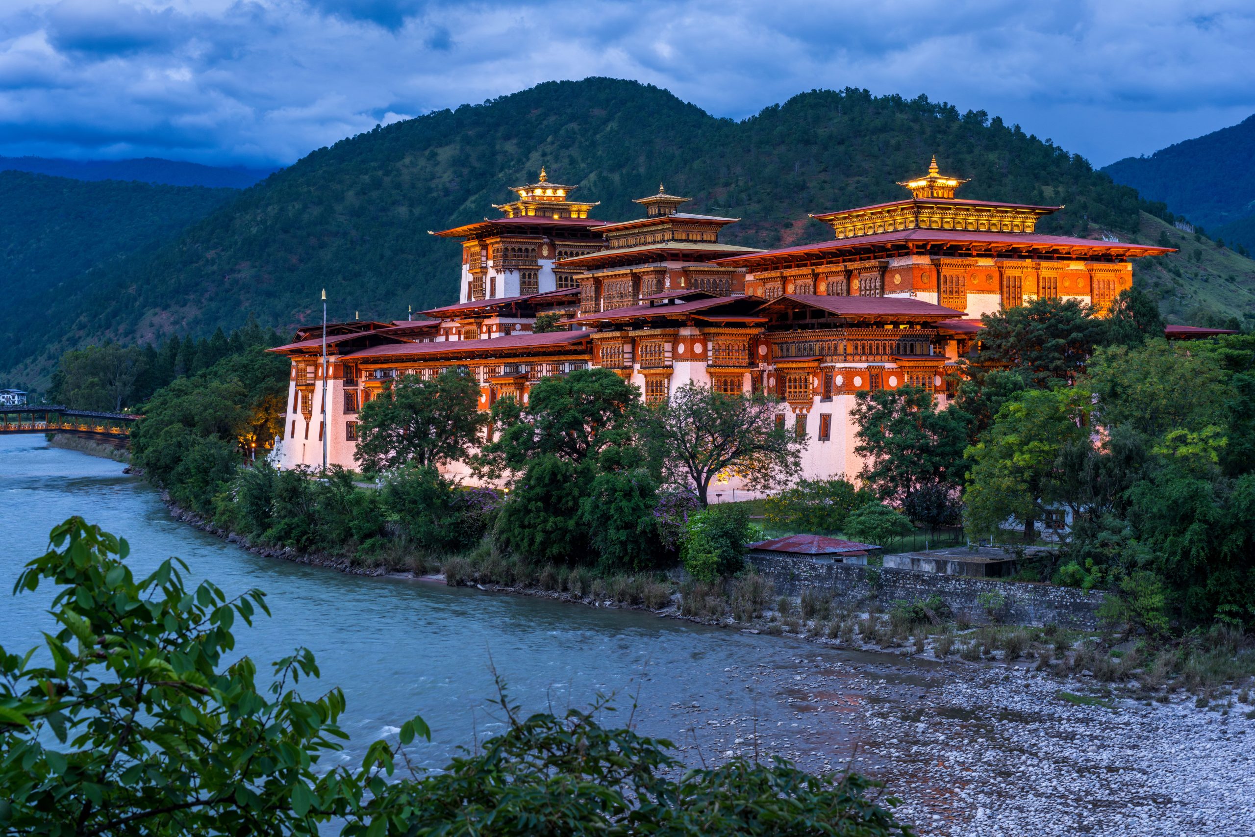
Your trek begins after a short drive from Punakha Dzong to Bhutan’s longest suspension bridge (180 m) spanning the Pho Chhu. The trail climbs gradually on the left bank of the river through terraced fields of mustard and winter wheat—Punakha’s fertile valley supports double cropping and an abundance of citrus and bananas in winter.
After approximately 2.5 hours of steady uphill trekking through pine, fern, oak, and occasional rhododendron, stop for lunch at a scenic clearing marked by a large prayer flag. On clear days, you may enjoy views of distant peaks including Mt. Jhomolhari, Kang Bum, and Tiger Mountain. Khamsum Yuelley Namgyal Chorten is also visible far across the valley.
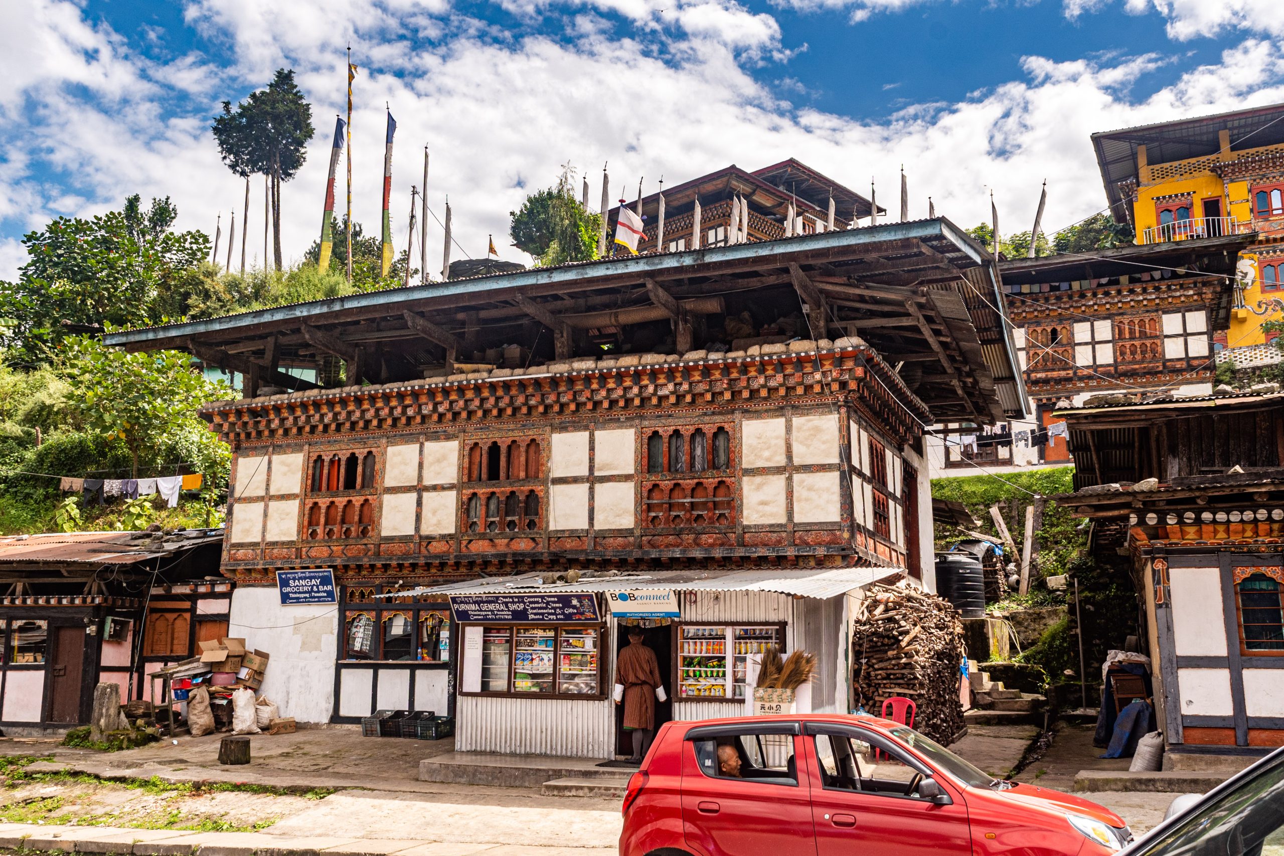
The ascent ends at a chorten near the ridge line (2,200 m). From here, descend gently to Limbukha village where the campsite lies just beyond on a grassy terrace. Limbukha, once thought to be the site of a sacred lake, holds unique traditions—including rituals performed before irrigation season. The village is dotted with large traditional houses and steeped in legend, including tales of an ancient king who once ruled the area.
After lunch, continue towards the picturesque Lingmukha Valley, also called Lingmup Sher Gi Zhom or “Golden Bowl,” due to its rice cultivation nestled between protective ridges. En route, visit Lingmukha Lhakhang, founded by the great treasure revealer Terton Dorjee Lingpa in the 4th century, known for its historical and spiritual significance.
Note: The first two hours of trekking are through forest; the final stretch follows a feeder road. As this route has road access, luggage is transported by 4WD vehicles instead of pack animals.
- Trek Distance: 12 km (7.46 miles)
- Estimated Duration: 4–5 hours
- Elevation Gain: 948 m | Elevation Loss: 81 m
- Start Elevation: 1,288 m | End Elevation: 2,147 m
- Overnight: Campsite at Limbukha
After breakfast, continue hiking toward Chungseykha, a trail once traversed by the closely bonded communities of Lingmukha and Phangyul. Although divided by a steep ridge, these two villages share common ancestry and cultural heritage.
Climb steeply through lush forest until you reach a ridge-top rest stop. From this point, descend sharply while enjoying expansive views of the Shar Valleys. Time permitting, visit Chungse Azhe Gyalzom Lhakhang, a temple built at the spot where the Divine Madman, Lam Drukpa Kuenley, is said to have miraculously landed a small disc-like stone (chan-do) thrown from Sha Kuenzangling.
The descent continues through small farming settlements to the junction at Chungseykha and Samtengang, where your vehicle will be waiting to transfer you to your overnight accommodation.
- Trek Distance: 13.85 km (8.61 miles)
- Estimated Duration: 6–7 hours
- Elevation Gain: 935 m | Elevation Loss: 1,133 m
- Start Elevation: 2,147 m | End Elevation: 1,950 m
Additional Activities
- Archery or Khuru (traditional dart) lesson/demonstration
- Cooking class
- Hot stone bath
- Farmhouse/homestays – OVERNIGHT OR VISIT
- Cultural Program
- Picnic Lunch
- Cycling / Motorcycle rides
- National dress/costume trial
- Gala Dinner And Cocktails
- Private guest lectures on Buddhism and Gross National Happiness.
- Private Yoga Sessions
- Helicopter Rides
- Smoke Offering / Flag Hoisting / Organizing Private Religious Rituals / Spiritual Cleansing Ceremony / Butter Lamp Offering
- School Visits